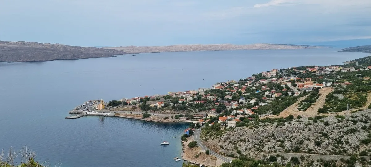
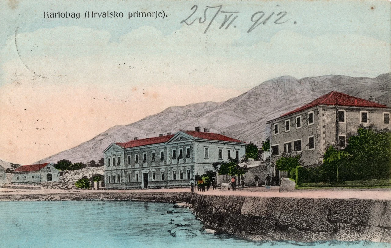
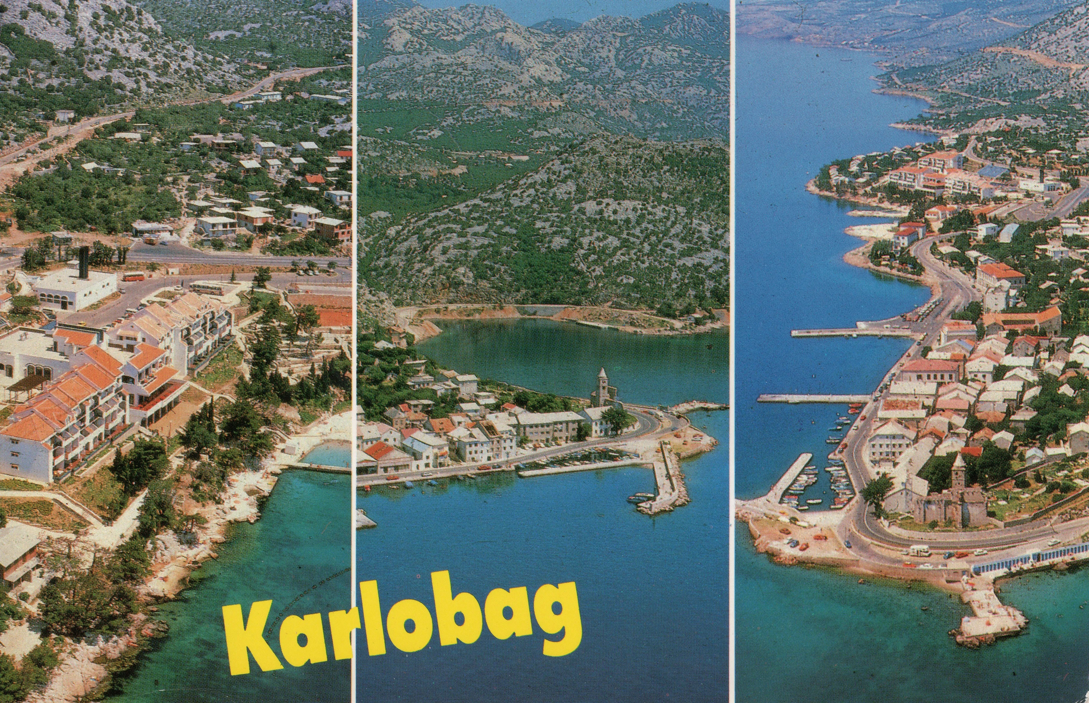
A view of Karlobag and the Adriatic Sea – peace and natural beauty in a single frame.


Virtual Exhibition: A Memory of Sea, Stone, and Velebit

Welcome to 'Karlobag through Postcards' – your virtual sanctuary on the shores of the Velebit Channel. This is a place where history meets precious memories, and where the mighty Velebit mountain blends with the crystal-clear Adriatic Sea. Through hundreds of vintage postcards, we take you on a journey into the past, revealing how this unique town has changed over the decades. Feel the scent of salt, pine needles, and the summer Bura wind as you explore our galleries, landmarks, and stories of life in Karlobag.
This project is dedicated to preserving local heritage and is freely available to the public for educational and cultural purposes.
Take a look, explore, and discover the indelible mark of Karlobag – let us preserve it for future generations.
A view of Karlobag and the Adriatic Sea – peace and natural beauty in a single frame.
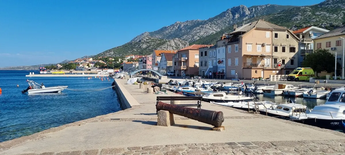
On the pier (molo), an old cannon recalls the rich history of this place, while small boats gently rock in the little harbor. In the background, the imposing Velebit peaks rise, lending the entire scene a dramatic yet gentle silhouette. Karlobag here acts as an ideal place where history, nature, and the Mediterranean spirit meet – a place that invites you to walk the waterfront, enjoy the view, and the silence of the sea.
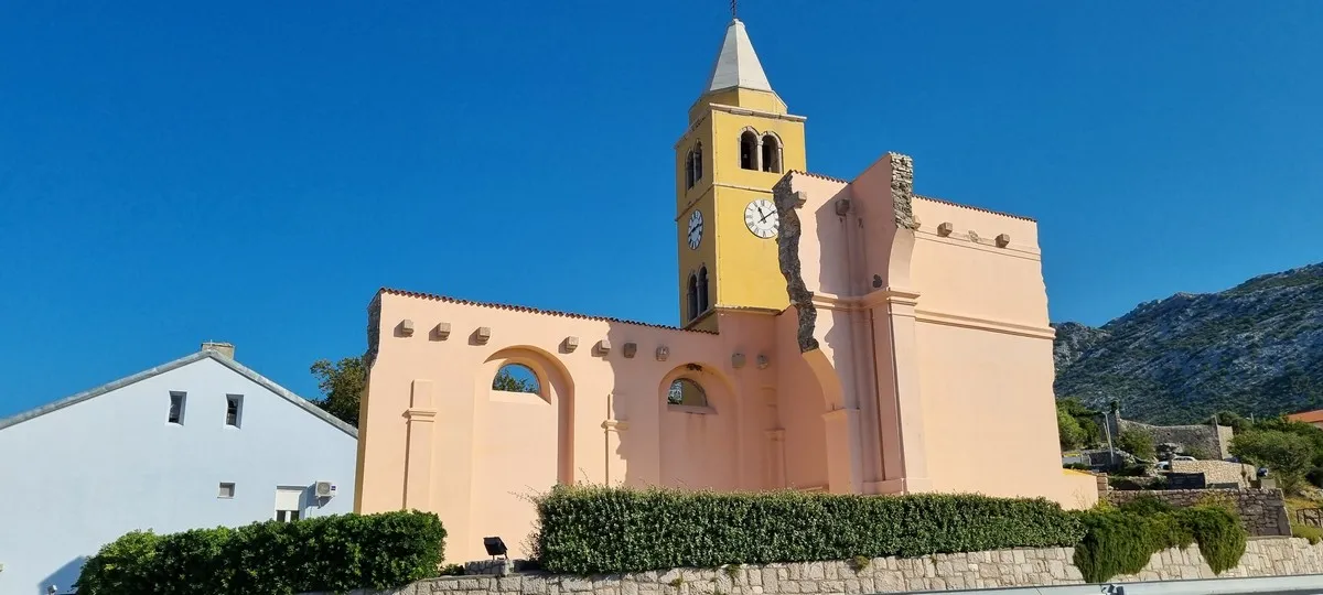
The Church of St. Charles Borromeo was built in 1710 on the foundations of the older Church of St. John. The church was heavily damaged during Allied bombing in 1944. When the construction of the new main road (magistral road) began in 1958, the church's external walls were demolished and its remains removed. Only the bell tower and one section of the wall were preserved. The bell tower and the remaining wall were restored, and their ceremonial opening was held on the feast day of St. Charles in 2000. Today, they form a memorial site and are protected as cultural heritage.
The lighthouse in Karlobag has for decades accompanied ships, withstood the Bura wind, the Jugo wind, the sea, and the salt, and safely sent off and welcomed many crews. For years, it would send off and welcome our "Vanga" as it emerged from the Pag Channel and slowly sailed towards it, and we, the children, would jump on the top of the pier (brac) and joyfully shout: "...there it is...".
The lighthouse was built in the 1970s in the Strojna Tovarna in Livarna in Ljubljana, and in 2025 it was replaced with a new, modern lighthouse.
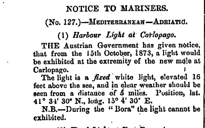
Translation of the Official Notice
NOTICE TO MARINERS.
(Br. 127.) — MEDITERRANEAN — ADRIATIC.
(1) Harbour Light at Karlobag (Carlopago). The Austrian Government has issued a notice that from the 15th of October 1873, a light will be exhibited at the extremity of the new mole at Karlobag.
The light is a fixed white light, elevated 16 feet above the sea, and should be visible in clear weather from a distance of 5 miles. Position: lat. 44° 31' 30'' N., long. 15° 4' 30'' E.
N.B. — During the "Bura" (strong northeasterly wind), the light cannot be exhibited.
These historical records from the British archives reveal the rise of Karlobag as an important trading port in the 19th century. The proclamation of the Austrian Government was published in The London Gazette, in the edition dated November 28, 1873.
The Crowning Work: The First Lighthouse
Following the completion of extensive modernization works on the port and the construction of the new pier (mole), Karlobag received its most vital navigational landmark.
The Challenge of the Velebit Bura
Even though the port was modernized with a new pier and light, nature remained relentless. Official notices to mariners, also published in the British press (The London Gazette), carried a crucial warning: during the "Bura", the light could not be shown. Despite the new infrastructure, the power of the wind beneath Velebit was often stronger than the technology of that era.
The newspaper excerpt has been taken from the official publication The London Gazette for educational and informational purposes.
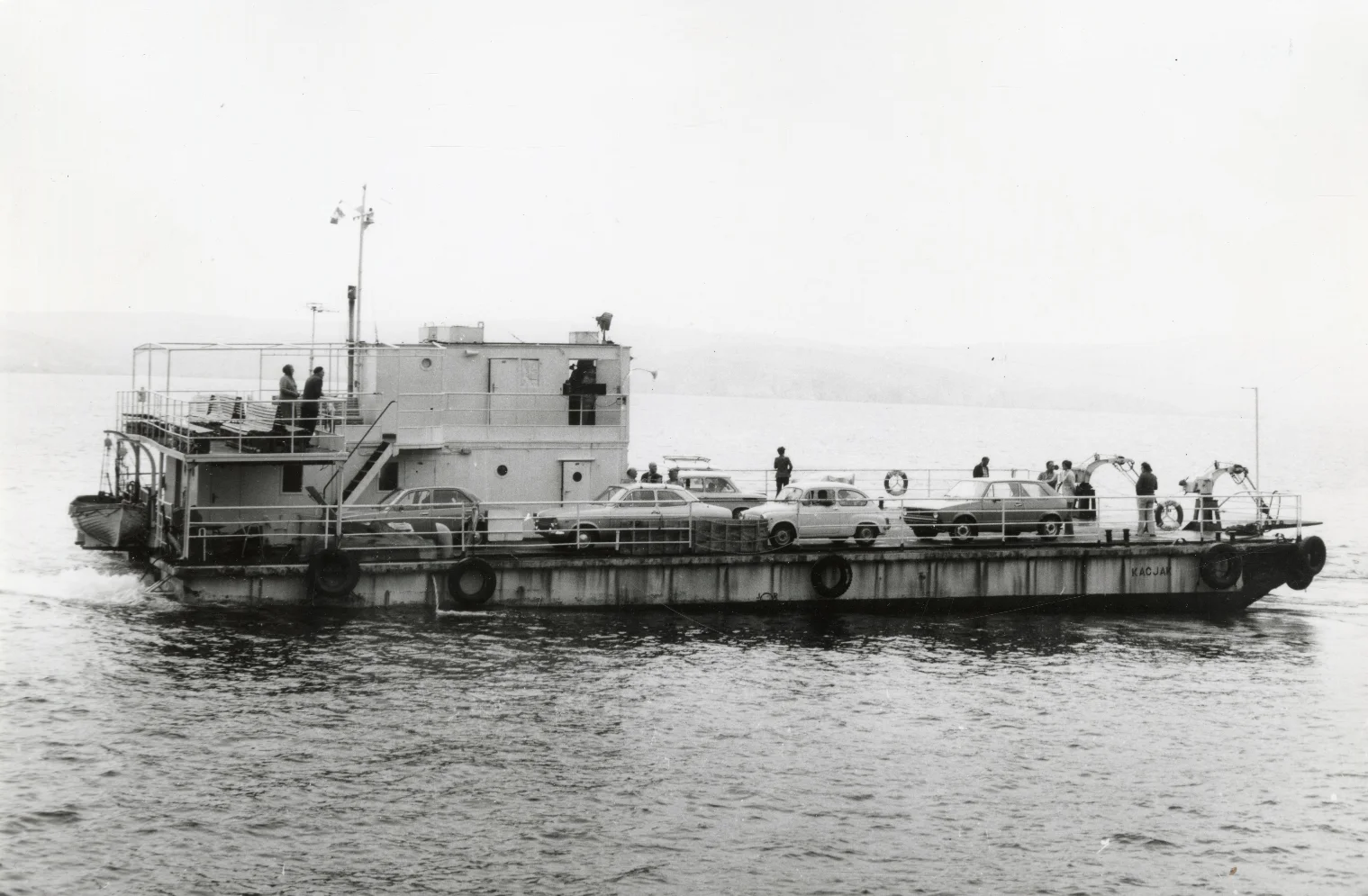
Motor Ferry "Kačjak" – Serial Number PDS 707
M/T Kačjak Rijeka - Jadrolinija (1970-1994). This ferry, originally a Yugoslav Navy (JRM) landing craft with serial number PDS 707, was built in Pula in 1954. In 1970, it was purchased by Jadrolinija and was one of the first of six identical "rafts" converted into ferries. In 1981, it was overhauled at the Punat shipyard. It served on the Karlobag-Pag line, and later on the Jablanac-Stara Novalja and Prizna-Stara Novalja routes, eventually operating between the new ferry ports of Prizna and Žigljen. On February 24, 1993, it arrived at the Novigrad Strait, where it was hit and disabled on February 25, 1993. In 1994, it was scrapped for metal in Punat.
Photograph of M/T Kačjak were retrieved from the Maritime and History Museum of the Croatian Littoral, Rijeka, for educational/content purposes.
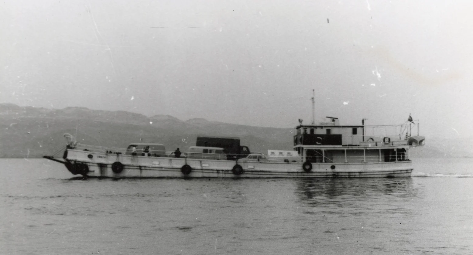
The "Vanga" Motor Ferry – The Story of a Lošinj Wooden Beauty
Photograph of M/T Vanga were retrieved from the Maritime and History Museum of the Croatian Littoral, Rijeka, for educational/content purposes.
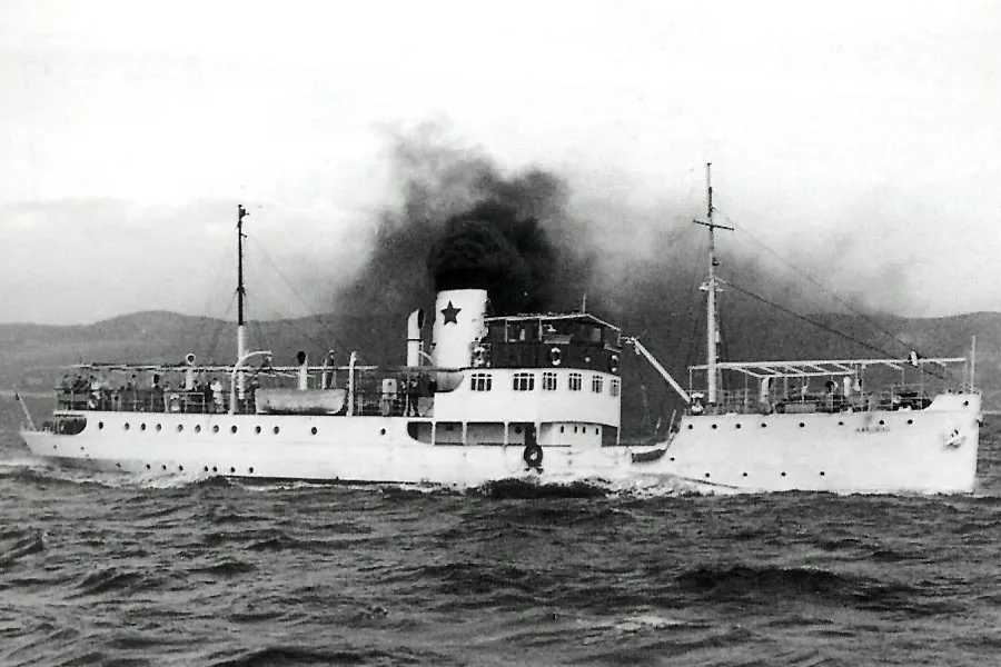
Various steamers have arrived in Karlobag since the beginning of the 19th century, among them the steamer Karlobag. During its rich history, the ship changed names and flags:
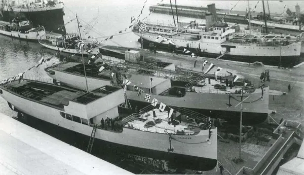
The image shows the ships Šumadija and Sarajevo during construction in “Jadranska brodogradilišta u Splitu” (Adriatic Shipyards in Split).
The photographs of the steamer Šumadija/Karlobag were taken from the internet for educational/content purposes
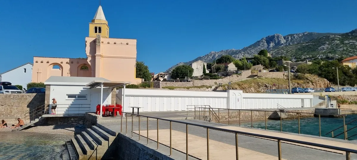
The town beach in Karlobag was built during the time of the Austro-Hungarian Monarchy. Although precise data is not available, it is assumed that Mollinary, who was constructing a school, a waterfront (riva), and roads in Karlobag at the time, was responsible for its construction. The beach is considered one of the oldest town swimming areas on the Adriatic.
The Karlobag town beach was renovated and ceremoniously opened in 2023.
February 15, 2026:
February 17, 2026:
February 18, 2026:
April 26, 2026:
May 7, 2026:
May 22, 2026.
Austro-Hungarian stamp
Shows the Civil Higher Public School (1875).
Unposted
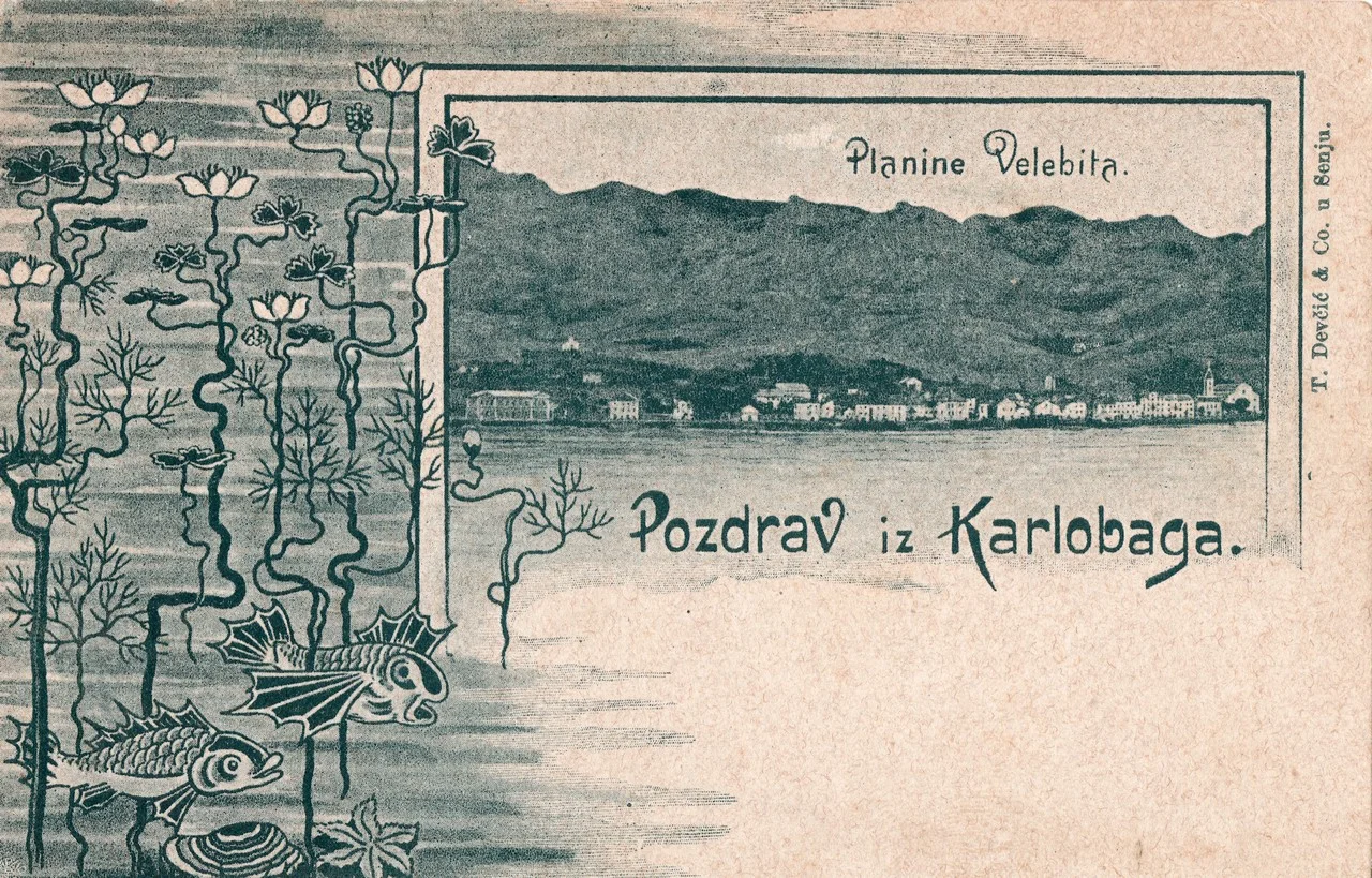
View from the sea towards Velebit and Karlobag.
SFR Yugoslavia Stamp
Displays a panoramic view of Karlobag.
Be the first to like and share us.